
Welcome to the NJ State Climate Office
Welcome to the new, integrated site for the New Jersey State Climate Office and the NJ Weather Network. This site showcases both historic, climate products as well as real-time observations from the 70 station NJ Mesonet and other weather stations throughout the region. Please submit any questions, feedback, or concerns using our contact form.
The NJ State Climate Office offers a robust catalog of climatological data and analysis, including some products that include data as far back as 1895. You can explore NJSCO products via the "Climate" and "Publications" menus above.
The NJ Weather Network provides real-time, localized weather data. This data is available in a variety of formats, including interactive visualizations like the map seen above. You can explore NJ Weather Network products via the "Weather" menu above.



The Rutgers Climate and Energy Institute seeks to contribute to a resilient, equitable, and sustainable climate future. RCEI connects faculty, staff, and students through transformative climate change research, innovation, education, and outreach.

The New Jersey Climate Change Resource Center helps address climate change issues in New Jersey from emissions reduction to building adaptation and resilience by providing actionable science, planning tools, technical guidance, and support to policymakers, practitioners, and communities.

Committed to supporting the Rutgers community as we work towards a more just, sustainable, and resilient future for the planet and all of its residents. Our mission is to transform Rutgers into a living lab for climate action.

The Rutgers Global Snow Lab generates various unique products regarding global snow cover. Maps, graphical products, and tabular data are all available.

Led by a team at Rutgers University, MACH brings together academics, policymakers, and community leaders to research climate change impacts and inform evidence-based, flexible, and robust climate risk management in the Philadelphia-New Jersey-New York City region and beyond.
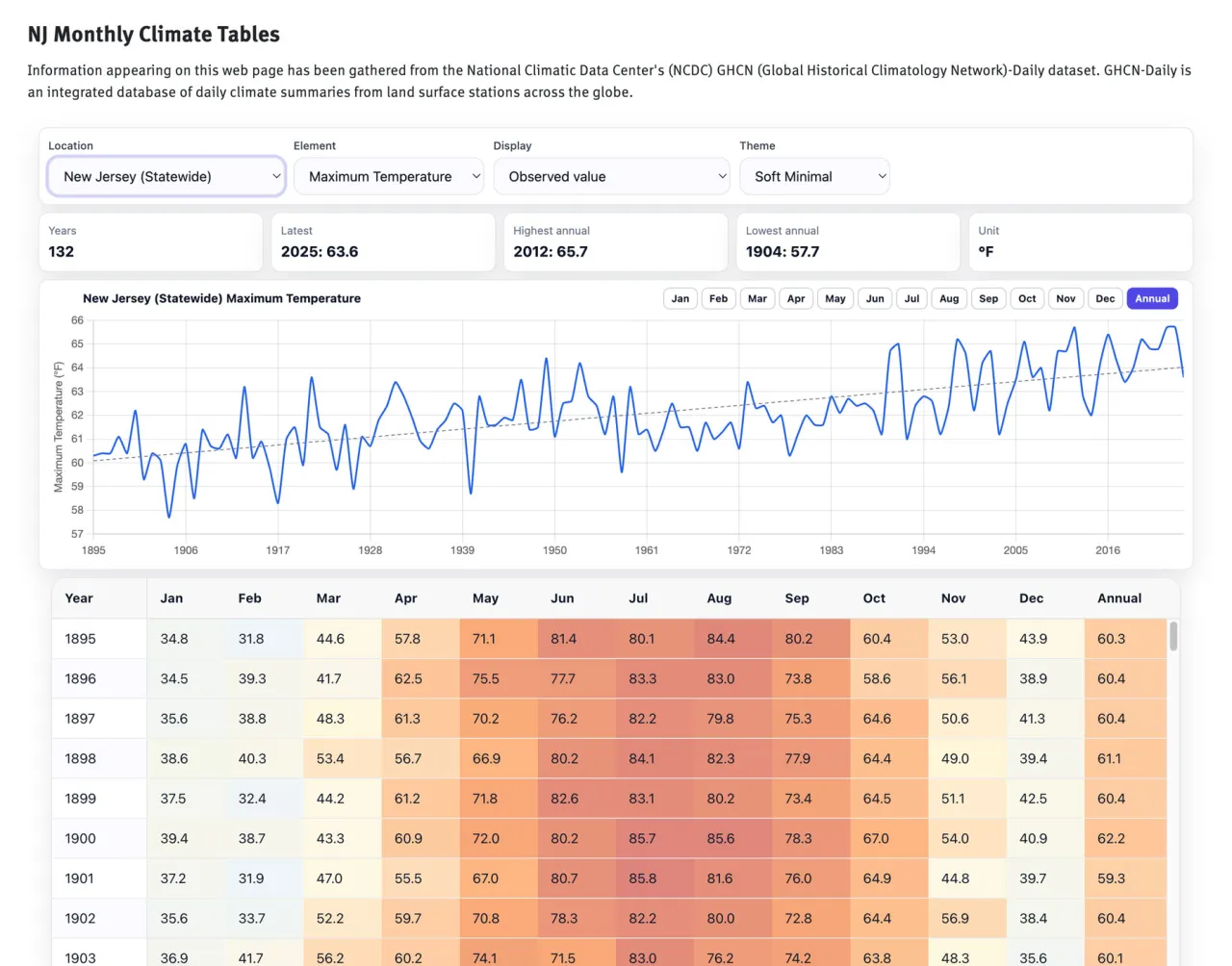
Our featured product this month is our Monthly Climate Tables. The monthly data are sourced from the U.S. Climate Divisional Dataset (NClimDiv), which is a long-term temporally and spatially complete dataset from 1895–present for the contiguous United States, including NJ, its 3 climate divisions, and all 21 counties. The dataset is maintained by NOAA’s National Centers for Environmental Information (NCEI) and provides temperature and precipitation statistics, as well as heating and cooling degree days.
Divisional values in NClimDiv are derived from area-weighted averages of grid-point estimates interpolated from station data. A nominal grid resolution of 5 km is used to ensure that all divisions had sufficient spatial sampling and because the impact of elevation on precipitation is minimal below 5 km. Station data are gridded via climatologically aided interpolation to minimize biases from topographic
and network variability.
The Global Historical Climatology Network (GHCN) Daily dataset is the source of station data for NClimDiv. GHCN-Daily contains several major observing networks in North America, with the primary network in NJ being the National Weather Service (NWS) Cooperative Observing (COOP) program, which consists of stations operated by volunteers as well as by agencies such as the Federal Aviation Administration.
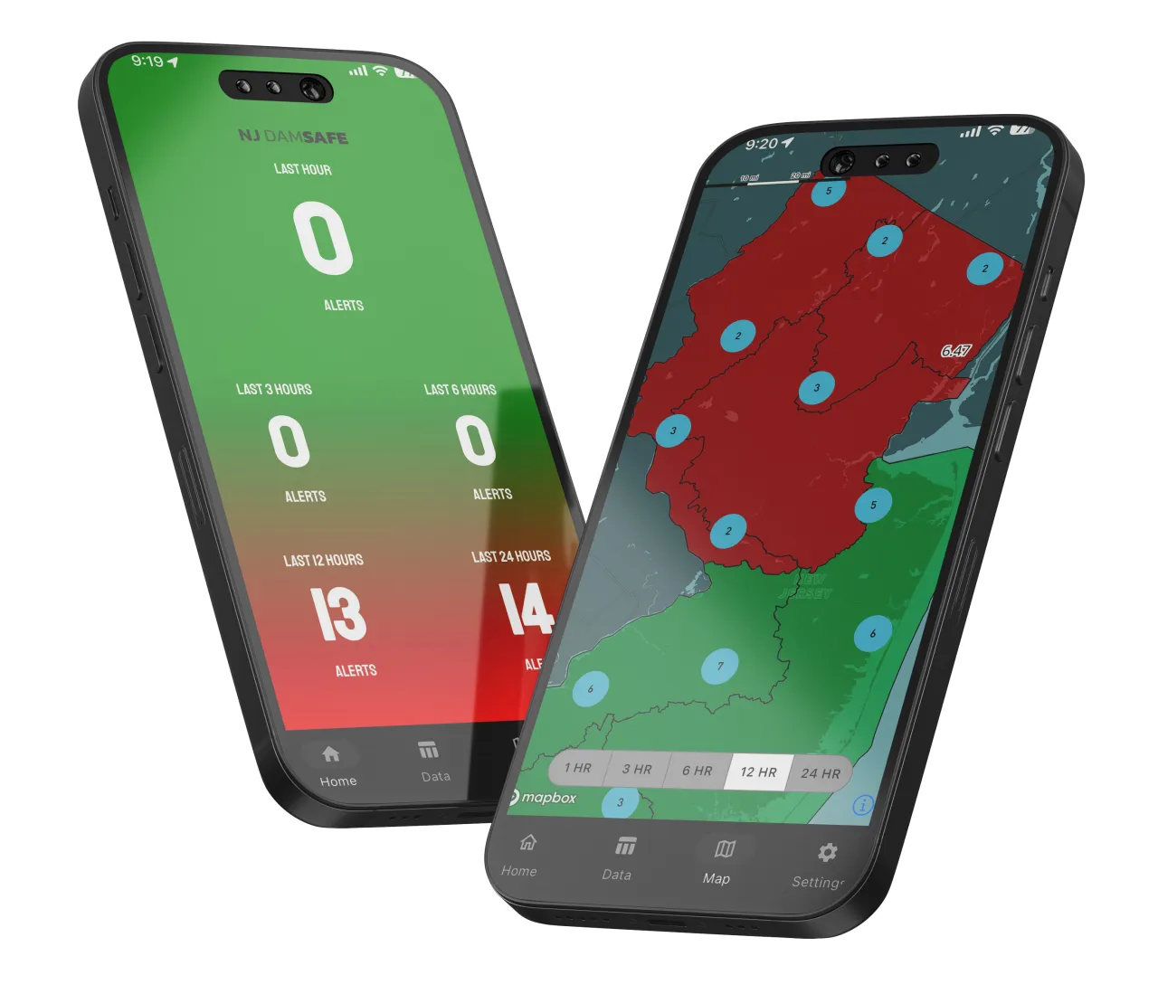
In partnership with the Bureau of Dam Safety (BDS) at the New Jersey Department of Environmental Protection (DEP), the NJSCO created a real-time data analysis and alert system to help BDS staff more closely monitor and react to threats to the more than 1,700 regulated dams within the state.
The NJ DAMSAFE app analyzes precipitation events statewide by utilizing real-time station data from over 160 precipitation gages distributed throughout the state of New Jersey. Monitoring is performed for six distinct hydrological regions defined by the Department of Environmental Protection. When accumulating precipitation exceeds certain thresholds, alerts are issued to BDS staff, allowing them to proactively address developing threats to NJ dams.